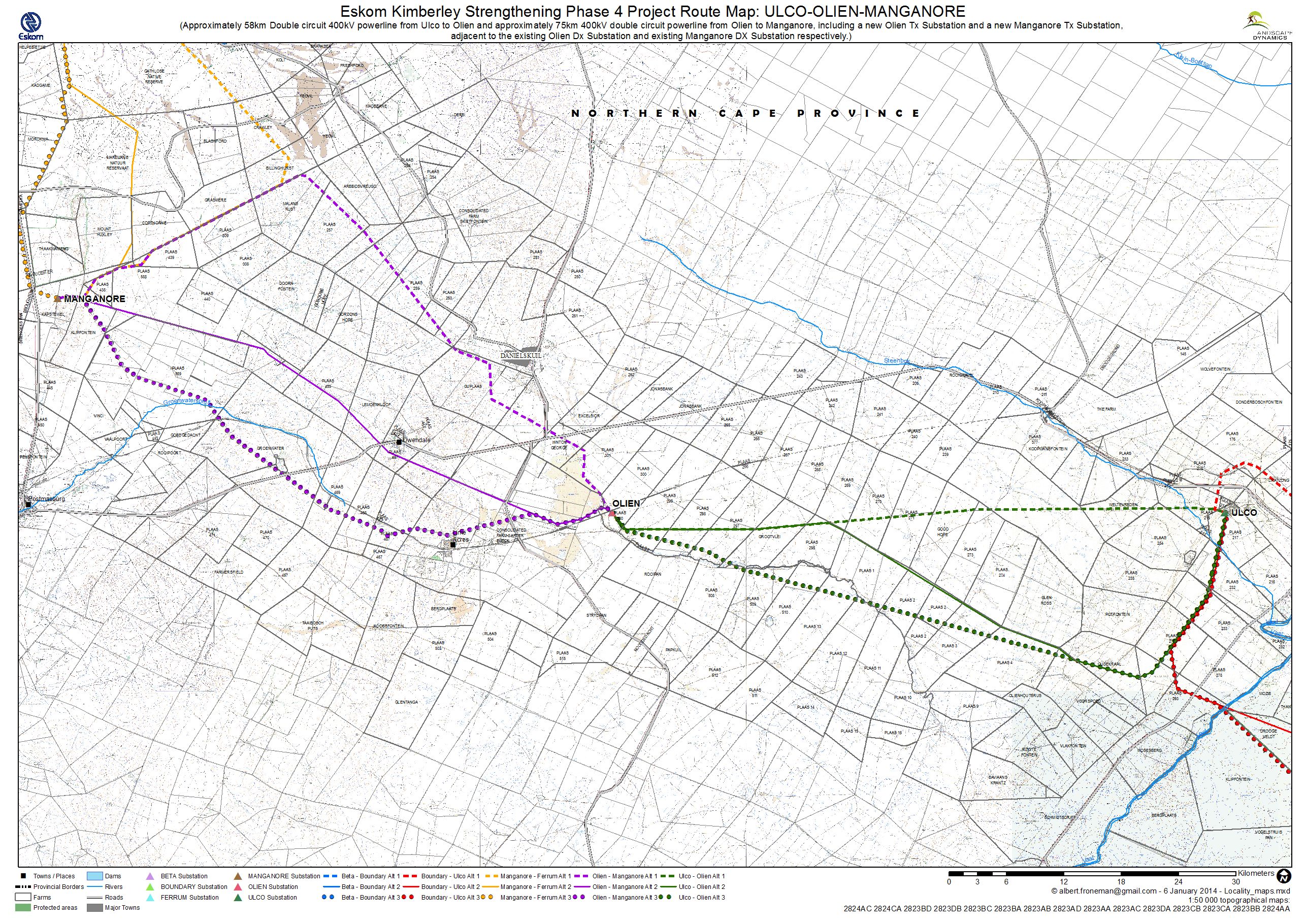
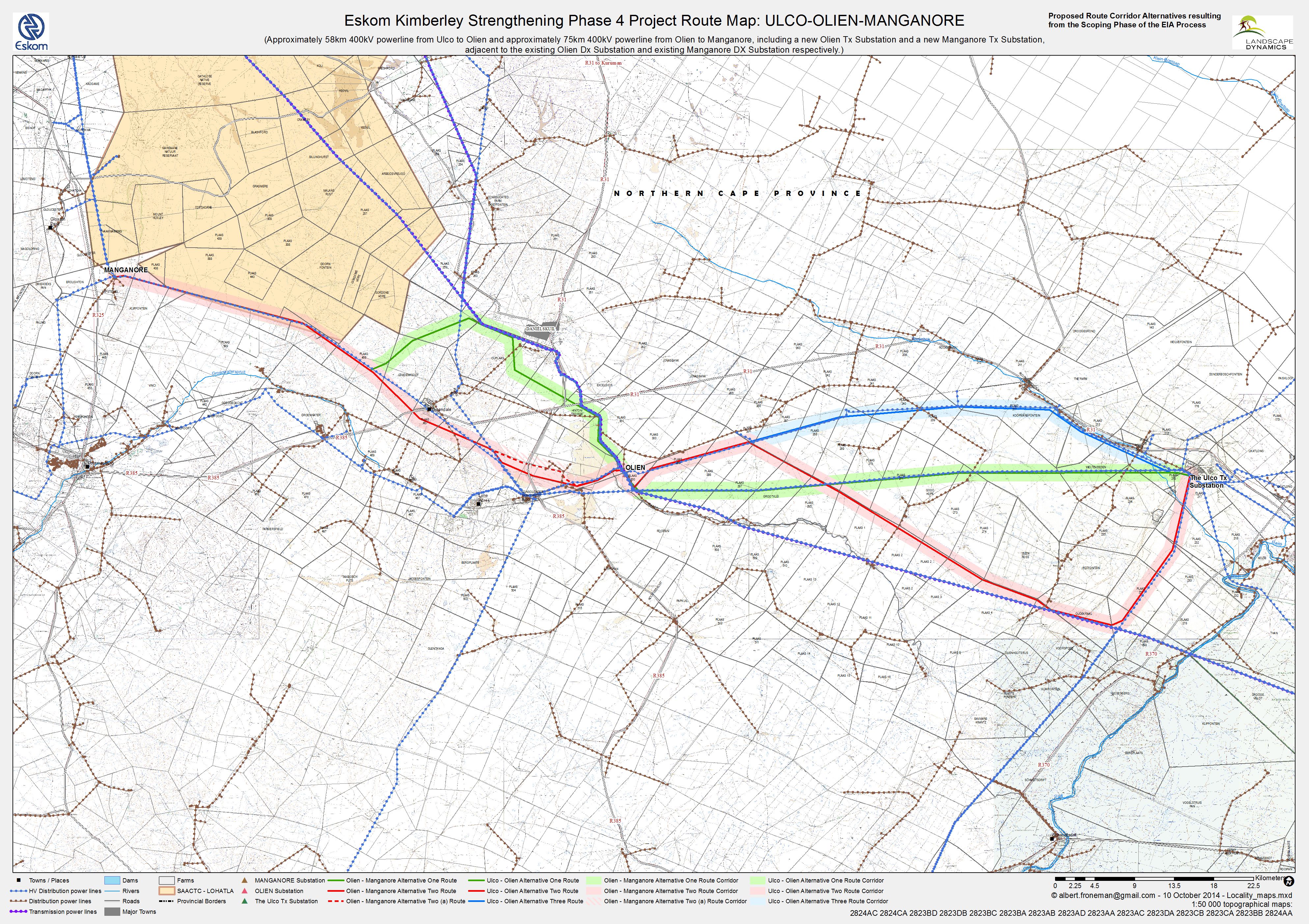
Ulco Documents Cover page Final EiR Ulco-Olien-Manganore KMZ file of Final Routes List of Contents Final EIR Ulco-Olien-Manganore A1 – 1 to 250 000 Locality Map A5.1 – Route Map of Preferred and Alternative Corridors proposed for EA A5.3 – OlienManganore info and 250m coords A6.1 – Ecological sensitivity of the different identified vegetation units A6.2 – Freshwater Constraints Map A6.3 – SANBI National and Municipal Wetlands – Ulco Olien Manganore A6.4 – SANBI Rivers and Catchments – Ulco Olien Manganore A6.5 – SANBI National Protected Areas – Ulco Olien Manganore A7 – Photos of the Study Area Ulco – Olien – Manganore Final KML Ulco Olien Manganore Final EIR A2 – Route Map of Corridor Alternatives investigated A3 – Route Map of Corridor Alternatives as amended A4 – Route Map of Corridor Alternatives resulting from Scoping Phase A5.2 – UlcoOlien info and 250m coords B(1) Technical Information B(2) Eskom Guide Servitude Consideration C1 – Engineering Geological Investigation C1 – Fig1a C1 – Fig1b C1 – Fig2a C1 – Fig2b C1 – Fig3 C1 – Fig4 C3 – Palaeontological Impact Assessment C2 – Soil -Agricultural Potential Report